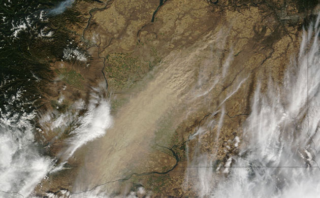
Visibility dropped to zero in parts of eastern Washington on 4 October 2009, as a large dust storm blew through. According to local news, the storm brought strong winds gusting to 43mph in places that propelled the dust across the south-east corner of the state. A thick, rippling plume of dust runs north-east to south-west through the centre of this image. Dust stretches as far south as the cities of Pasco and Kennewick, which sit on opposite banks of the Columbia River. In the north, the dust seems to rise primarily from the pale golden squares of fields farmed using dryland agriculture, a common practice in arid eastern Washington. The dryland fields are larger and less colourful than the bright green and gold fields of irrigated agriculture near the Columbia and Snake Rivers in the center of the image
Photograph: Terra/MODIS/NASA
The Guardian
Comments