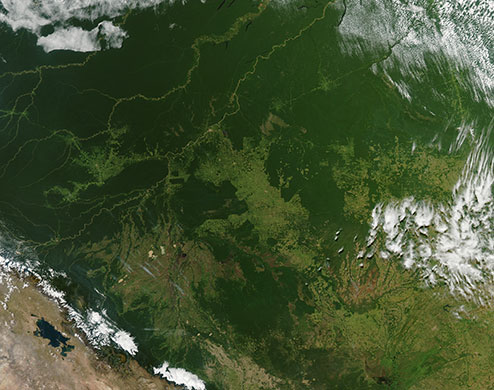
The Amazon region of Brazil, on 12 May, 2010. The red dots are the locations of active fires, which are likely the result of agriculture. The Amazon rainforest (top left) is becoming fragmented by areas of deforestation, which appear as geometric shapes of light green amid the deeper green of remaining forest. The Amazon river runs across this region, but further north than this view shows. The three rivers that run diagonally across the top left corner of the image are Jurua, Purus and Madeira. Rio Madeira runs along the Brazil-Bolivia border for a short time before it continues into Bolivia. Rio Purus runs into Peru. Lake Titicaca is visible on the Peru-Brazil border at the bottom left. It is the largest lake in South America
Photograph: NASA
The Guardian
Comments